Category Archives: Sports

Around the Schönbuch

The “Schönbuch” is a forest area, under protection, just next to my home-town Holzgerlingen. Of course the pathways in the forest are not paved, so with the road-bike we have to go “around”. Which is a quite nice tour, with some really great views, and can be made between 65km and 80km long.

We’ve done this a few times this year, on different routes, and today was a nice Saturday to repeat another variation. Over the broad B464 “highway”, which is currently quite deserted due to road-constructions which causes most cars to go a long de-tour. Road for the bikes… This time we went to Pfrondorf and down to Kirchentellinsfurth. Quite a few times already we climbed this hill, and are usually a bit exhausted as this is then one of the last climbs of a larger tour. Today downhill… and that is really nice. So we continued via Tübingen towards Entringen.

The colors were really great today. It is still summer, but the sun is not anymore coming straight down, so it seems like the colors are more intensive. The white clouds against the blue sky were fantastic today. And going over hills… you often have fantastic views. First towards the “Schwäbische Alb” and then towards the Schönbuch again, with the town of Entringen. Had to take a picture.

IMG_0238.JPG
View towards Entringen and the Schönbuch

All in all we did a relatively relaxed tour today, 72km and 540m altitude with 26,6 km/h. After a rainy week, we were once again lucky with the Saturday weather. Unfortunately the Sunday forecast is bad, rainy 🙁 .

The 5-hills tour in the Nagold valley

For a few years already we discuss regularly to run a “mountain training” along the valley of Nagold. Finally yesterday we managed. My legs today tell me, that we completed successfully!

Yes, there are of course several more climbs, but I selected 5 really nice ones and some of the steepest. The first was just to warm up, from Dätzingen towards Calw. But then first bummer, the “Öländerle”, with 15-18% steep sections. But actually quite good to climb, as there are several steep sections followed by slightly less steep parts, followed with another ramp… several times. Reaching Stammheim for a quick flat part, the climb continues towards Holzbronn to complete hill number 2.

First downhill again into the valley, and now up from Seitzental towards Altbulach. This is really nice to go, not quite so steep, I guess up to 12%. Once up, continuing in direction towards Wildberg, there is a fantastic view into the valley and over Wildberg. From here it’s already possible to see hill 4 (although not on the picture).

Blick auf Wildberg

Downhill to Wildberg we quickly cross the town on the bikeway along the Nagold river… but only shortly, as directly after the town the next hill starts left-hand of the regular bike-path: Hill 4 “Kühlenberg”. This is another bummer, starting with a normal climb, quite suddenly the steepness increases to 18% for several long ramps. Nice!

Reaching Oberjettingen via the farms (the “Höhenhöfe”), we continue down via Emmingen towards Nagold. Here we have earned a break with nice cakes and coffee. No cowards today, we take on the last one, Hill 5: directly out of Nagold we climb up the “Eisbergsteige”. Starting with the end of the houses in Nagold, this climb provides a constant climb of 15-18%… no breaks or relaxing parts. Well, I chose it that way, so no complaining… and we did it 🙂

The pure statistics doesn’t sound spectacular: 110km, approx. 1400-1600m altitude with average speed of 24 km/h, but the number of ultra-steep climbs makes this a really special one. I guess we should be well prepared for the “RTF” in Magstadt next week.

Tour on GPSies:

Hohen Neuffen

Mid of the week, the weather forecast was not very good. So it was a positive surprise that it was pleasantly warm and no rain forecasted until later in the day. So we decided to ride up the “Schwäbische Alp” at Neuffen.

Well known that the terrain before the “alp” is pretty hilly with a few rather steep climbs. But at the beginning of the tour, that’s OK. As usual, I planned the tour through small side streets and bike-ways, so we could enjoy the scenery. From Neuffen there is the climb up the Alp, with 250m altitude and 6-9% ascent. A bit of a challenge, but we are fit enough by now. We were up so early, around 11:15, that we decided to visit the old castle “ruin” of Hohen Neuffen.

Blick von Hohen Neuffen
View from Hohen Neuffen

I cannot remember having been here… and was very pleasantly surprised. Not only the view is great, the “ruin” Burg Hohen Neuffen is being renovated carefully, so it looks like a ruin from far away, but insight is a Restaurant and you can even rent the place for company or private events, especially for weddings this is a great place.

Falken auf dem Hohen Neuffen
Falcon / Hawk on Hohen Neuffen
Bussard auf dem Hohen Neuffen
Buzzard on Hohen Neuffen
Falkner Wolfgang Weller


Then we saw birds, buzzards and hawks, on one of the elevated places. On Sundays and holidays, there is a falconer show there. So we didn’t take long to decide to stay and watch the show. Being here so early, waiting 20 minutes would be worth it. The show was planned for 12:00 with about 45 min. duration. It was fantastic!!! The Falconer Wolfgang Weller not only ran a great show with his birds, with hunting at highest speed, he also explained a lot of very interesting facts about the birds. Where they are from, how it works to “tame” and control them, and how they hunt in free nature. A real highlight!

Well, from there on, the rest is quickly told. We returned via Bad Urach and Metzingen into the valley of the Neckar and then upwards via Kirchentellinsfurth and Pfrondorf. In total the tour was 120km with 1130m altitude and average speed of 25,6 km/h (Tour at GPSies).

Hindelang, Oberjoch, Valley of Tannheim

On Wednesday I went to the Allgäu, a region in the south of Germany, close to the border to Austria. On Wednesday and Thursday a fellow rider was also here in the same town, so we did two tours together. A small and fast one with 60km to warm up on Wednesday, small Tannheimer-Tal tour (GPSies), … and on Thursday a long one with 1330m altutide and 120km, the Namlos-Tour. Unfortunately it rained. The tour itself is great, but we had two times rain for several kilometres, so it was a hard day.

On Friday it rained, so one day to relax. Today I did again a nice tour, via Wertach to Sonthofen and Hindelang and from there climbing the pass up to Oberjoch. Picture from a view-point near Oberjoch:

20140621-151212-54732407.jpg

From the view point I continued to Oberjoch and down into the valley of Tannheim. As I was there early, I did a small detour to the Vilsalpsee:

20140621-151214-54734511.jpg

From there I went to Grän and returned via Pfronten to Nesselwang. Nice tour with 86,6km and 900m altitude (Route on GPSies). Will see if I have enough power tomorrow for a big one…

Good biking week

The last 5 days I collected a good number of kilometers on the bike. First on Thursday the evening tour with the “Lauftreff Holzgerlingen” (57,3km) , then on Friday a smaller tour alone, to stay warm… (41km).

On Saturday then the RSG/fratelli tour. This time a ride via Bondorf and returning via Entringen, Mönchberg and Herrenberg up via the “bee path” (80km, Tour at GPSies). Great disappointment in Mönchberg, the spring/fountain is currently “closed” for renovation. No clear, cold spring-water for refreshment in the next several weeks.

On Sunday then the planned RSG club tour into the Black Forrest, to Simmersfeld. Finally we were 5 riders, one missed the start and called us a bit later so we waited for him in Gärtringen (thanks to cell phones). The tour was the “shortest” possible Simmersfeld-tour, but with summer temperatures of up to 35°C, no detours were planned. In Altensteig we had a nice break with cake and coffee. The first time since 3 years I chose Emmingen to climb back up out of the Nagold-valley. This is a nice alternative, in the town Emmingen are a few very steep passages, but after town, the rest is a nice climb and with partial Forrest and shade. So the longest weekend-tour was 120km and 1060m altitude (Tour at GPSies).

For the holiday today (Whit Monday), we chose to do only a smaller tour with about 75km and 630m altitude. In total this week: 372,5 km and 3160m altitude. The first summer weekend nicely used 🙂

Different type of work today

The day started cold and with a drizzle. Just about right to work at home. In the last weeks, I had so much “stuff” to do, that I did not manage the household… so a lot of small things accumulated. But now that is back in order.

Only around 4 o’clock I managed get onto the bike. But still the temperature was rather low, just around 14°C … I’d call that cold while riding. Only between Deckenpfronn and Kuppingen finally the sun came out. View in direction Affstätt and Herrenberg:

20140530-185136-67896396.jpg

Finally a nice little evening-tour, around ~50km.

Around Stuttgart

Mid of last week, Ralf asked, whether we would start at the “RTF” (organized bike tour) around Stuttgart (“Rund um Stuttgart”). In principal a good idea, but: Start/Finish in Untertürkheim, where we would have to start at the latest at 9:00 … which means we would need to take the train in Böblingen at 8:00. Hmm, that’s pretty early. And then I checked the tour… it goes via Sindelfingen/Ehningen and through Holzgerlingen, my home town!

So why not create a “Around Stuttgart Special” tour and ride the official track, but from “Böblingen to Böblingen”, great idea, right?

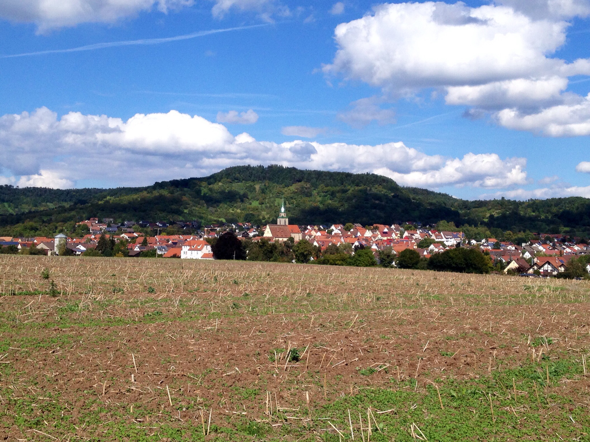
Thought, agreed, done: So we started at our club-house at 10:00, through the Aichtal at pretty high speed until Grötzingen where the tour started to go on roads that I didn’t know, as this is not my typical area. But with the RTF signs at every turn, it was easy to follow the roads until Untertürkheim through nice sceneries. Arrived at the start/finish area after about 50km, where we made a short break.

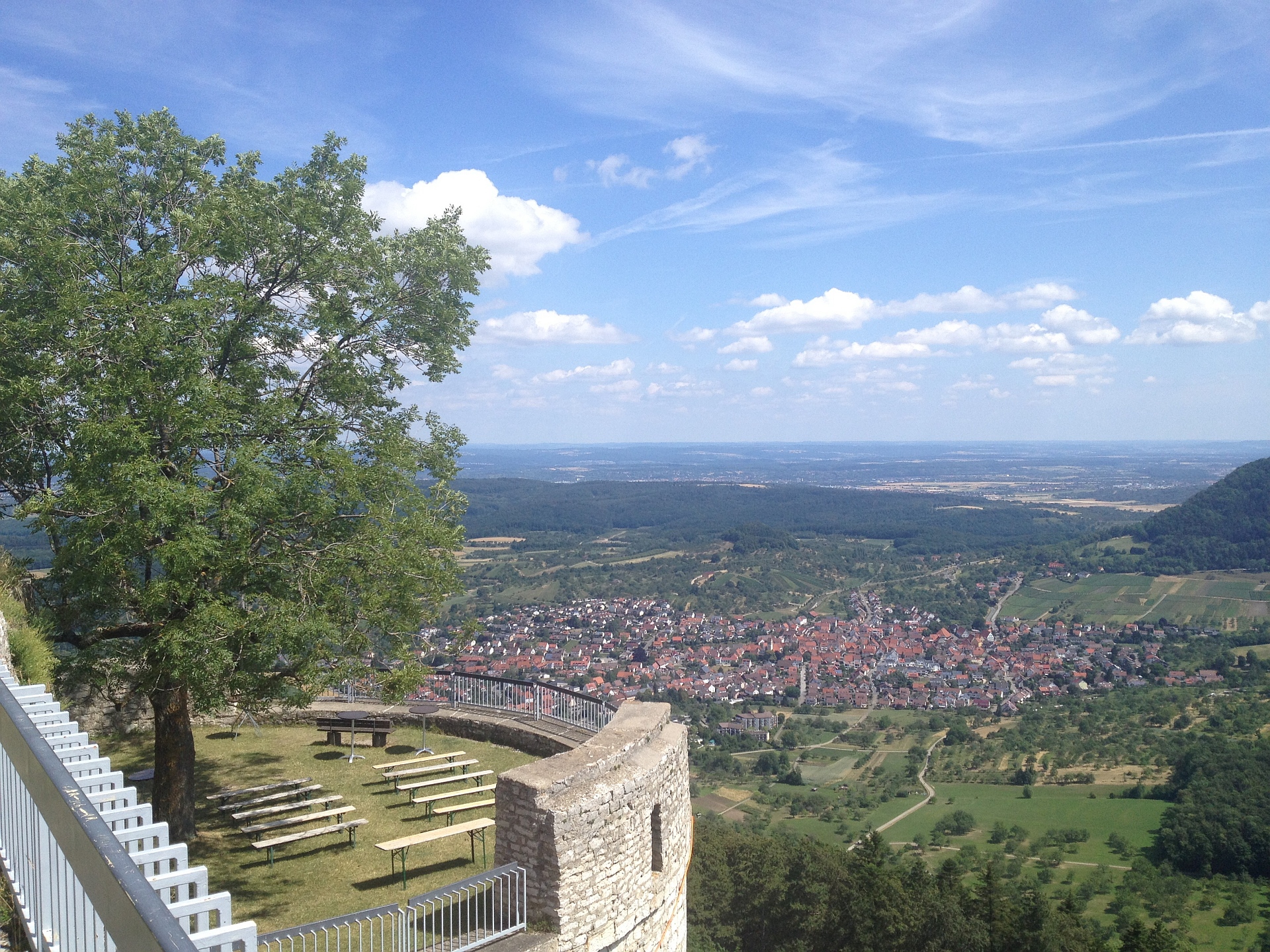
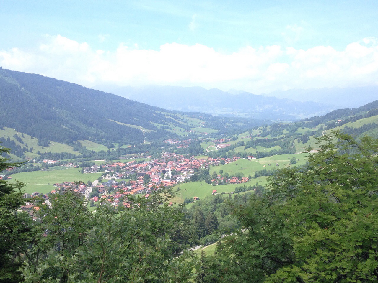
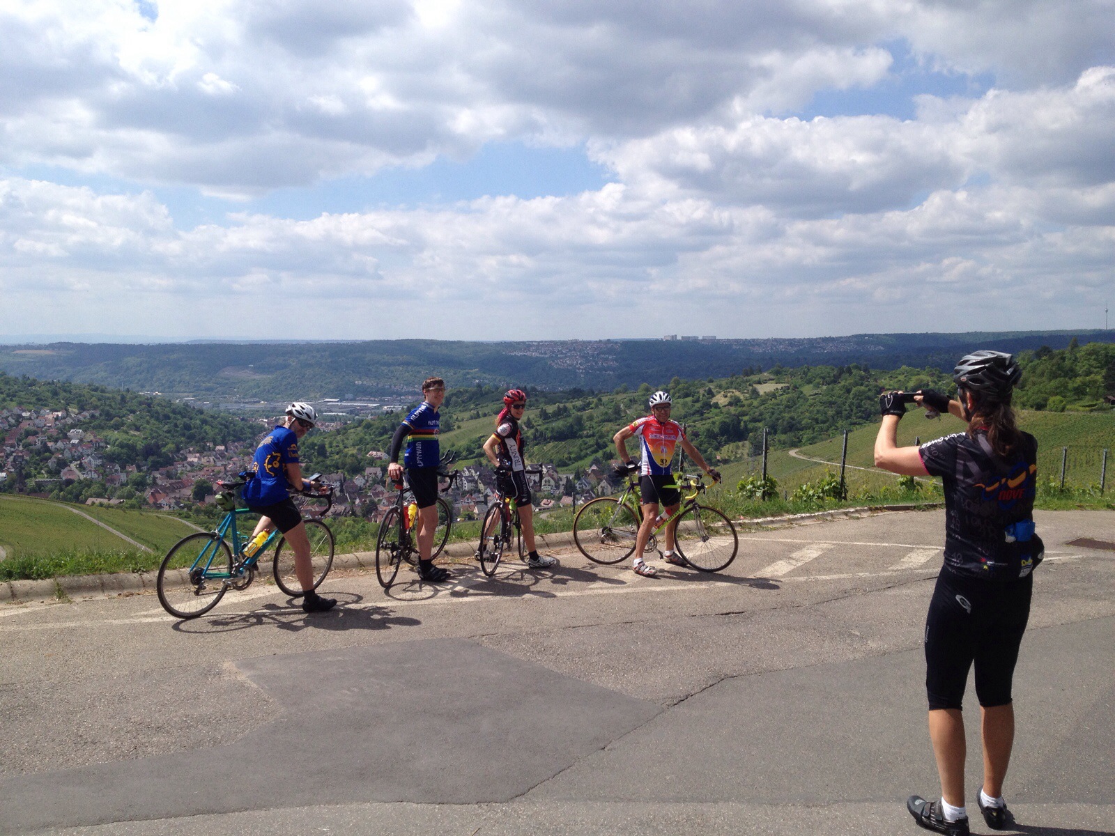
Then we started again and followed a sign “Tour A und B this direction”… OK, so we climbed the Rotenberg which is one of the nice hills in Stuttgart, about 200m altitude, with a great view over Stuttgart. Once being here, this is a view that you must enjoy:

Rotenberg

A small issue with that. This was not the official route. We must have missed a turn, so climbing up here was not really intentional. OK, same way back down. Checked the GPS track on the smartphone… shortly after the sign we had missed a turn left. OK, next try. A few kilometers through the vineyards … until the next road crossing. No RTF sign, checking the SmartPhone, we are on the right track. What’s up now? Well, after short thinking it became clear. The official start was planned until 9:00, but we were at the start only at 12:00 as we had left Böblingen only at 10:00. So the organizers had already started to remove the signs. Clearly my fault, bad planning.

So at first, I started to check the Smartphone at every road crossing that was unclear. But that doesn’t work well, you have to stop each time and wait, that is not “road bike” like. But Martin, one of our team, had a bike-GPS mounted and had done this tour already some 8 years ago, and still had the old tour stored. The old tour was a bit different, but at least this would allow us to follow directions without stopping.

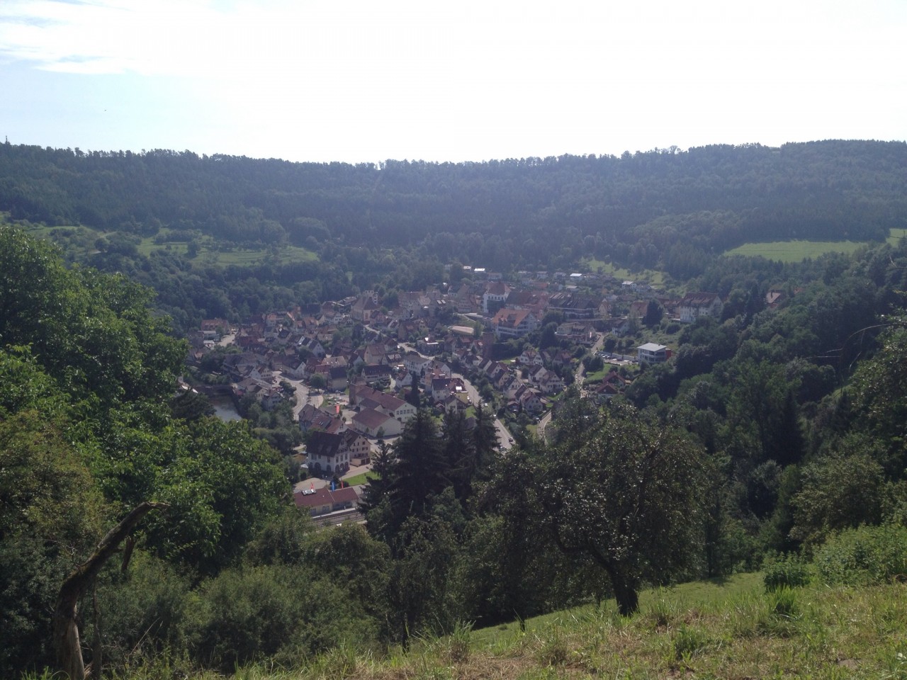
For the next few kilometers we first had to find to the right road of the old route and missed a few turns, so we stumbled across some of the outer parts of Stuttgart, until we reached the right track. Around Fellbach and Kornwestheim, the old route used a lot of main roads, so we had quite a lot of traffic. After about 20km we reached “outside Stuttgart” around Münchingen, Hemmingen and Heimerdingen, and things went much better. Very nice scenery again.

Shortly before we reached Magstadt, we followed known roads again, but I was a bit surprised about the road there. I already knew that after many, many years of construction work, the last bit of the new B464 was finished. However there was no side-road, and the B464 is like Autobahn, so we HAD to cycle almost one kilometer on the B464 until we could leave it and enter Magstadt. This is a bit strange. So here we left the official RTF track, as we all started to be a bit tired and wanted to take the shortest route back to Böblingen. After all, here is our home-turf.

Despite the extra-tours in Stuttgart, I think it was a nice tour, the views over Stuttgart on such a nice day were worth it. But next year we either have to prepare better by loading the official GPS track on a bike navigator,… or we don’t do the tour this day again.

Back home, I had 132,2km, 1.340m altitude with an average speed of  23,9km/h recorded. Not bad, I think we’ll all sleep well tonight.

More biking …

For a number of years I participate in the organized tours of my club  RSG and for the last 3-4 years, I organize the tours (RSG-Website, in German). Recently Brigitte who organizes the Holzgerlinger Lauftreff asked me if I could organize the routes for a few bike enthusiasts on Thursdays in the evening. So I volunteered spontaneously.

Last Thursday was the first tour, and I think it went pretty well. Every new group must learn a bit the coordination. We “lost contact” twice, and were a little disorganized to find us again, so finally we arrived back in two groups. Nothing that could not be solved the next time. The speed was a little bit high at times, again communication is something that can be learned 🙂

Although the forecast is really cold, we’ll do the second turn tomorrow. Looking forward to it and hope that people will come again and were not discouraged by the first time.