Found this video just recently. Not just is this sport fascinating, but more so the specific sounds that the skating makes. I guess this must be not just fascinating but almost transcendental for those who perform this type of sports..
Tag Archives: Nature
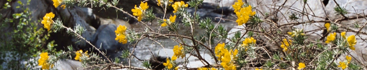
Patagonia – Part 1
This year I once again took the time for a longer vacation. Many years ago I had decided to do this every 3-4 years, however the last time was 6 years ago, South-Patagonia was over year-end 2010/2011. This time I went a few hundred kilometers further north to Patagonia.
I worked till Friday and left on a Monday, so I had the weekend for packing and preparation. It was a late / night flight, so I arrived in Buenos Aires on Tuesday. I had one day buffer in BA with Sun and 32°C, quite contrast to cold weather in Germany.
The continuation flight on Wednesday unfortunately had 2 hours delay, so I arrived only late afternoon in Bariloche. I got the rental car at the airport and had only little time to visit the nice and tourist oriented city center of the town… and then to enjoy my first real Argentinian steak!


I’m not here for eating only, and I’m an early starter. So next morning I left for a first trip, in car this time. The quite known “Circuito Chico”, the small tour in car through some of the nice areas around here. If you leave early, there is almost no traffic (which in any case isn’t too heavy here outside town). The only thing is that the cable cars only start around 10am. The trip is only about 2 hours driving, unless you take a side tour via gravel road to Colonia Suiza, so there is lots of time to stop for sightseeing and taking pictures. The road via Colonia Suiza is gravel road… that was my first time. Not as bad as expected, but still you have to get used to it… and I have a couple hundred more kilometers coming, so a little practice doesn’t hurt. As I was too early to begin, I took the cable car up to Cerro Otto at the end, with a small hiking to the highest place outside the station, where there was a fantastic view without other people.

A slow, leisurely start, but I’m here for hiking… for the next day I planned a trip to Refugio Frey, on the simple route. The driving to Villa Catedral is pretty short, so I started hiking form there around 9am. This tour is technically easy, it is specified as T2 (but only a small part, rest is T1), but with 18-20km there and back it is quite long, and also has 800m of altitude. So quite some training … and really nice landscape to enjoy.

I had feared muscle ache, but didn’t get any… so on the next day I took directly the next tour, to Refugio Lopez. The tour is shorter, the one-way 4-5km, so ~10km in total, but it is all the time very steep, it has also about 800m altitude. I think it’s a bit more difficult then Refugio Frey, but it is also marked as T2 on the map, probably right. But it’s quite difficult to hike almost all the time on steep rocky/gravel passages, so you need to concentrate, that’s why it may appear more difficult. Ah yes, by the way… T1-T5(T6) marked on the OSM, are the official classifications of the YDS scale.

This evening was Christmas Eve, so I had trout, just like I normally have at home 😀. The next day is Christmas, and after two days hiking, time to do “nothing” and relax. Well, nothing is really difficult for me, so I did some research and planning for “what’s next”. I wanted to check out the trail “Refugio Frey por el filo”, which is the trail via the ridge of Cerro Catedral to the Refugio Frey. Well, everything is relative, some people wrote it’s really nice and well marked etc., others write that is it T5 and really difficult. And on OpenStreetMap it is also marked as T5, so that means without practice in that kind of terrain, I should not do it. Therefor plan: take the cable car up to Cerro Catedral and check out the view and take some pictures. Can visit the ridge and check out how that looks like. There is one more day in Bariloche, so I have time.
OK, planned, done. Went again to Villa Catedral, bought the ticket for the cable car, nice trip up, first in a gondola then the last part a chairlift to “Diente de Caballo”. Well, this is a skiing area. So although the view is nice, the terrain is all being prepared for winter season, i.e. many machines and not a very natural area. The view to the lake and the mountains on the other side is nice, but nothing to stay long. So I hiked further up to the ridge to take pictures. there were a few other hikers just before me, obviously on their way to take the hiking trip along the ridge. So I followed them. Reaching the ridge there is a splendid view to Monte Tronador, the highest mountain the range near by.
Now I can see a part of that path along the ridge, quite impressive and a little frightening also. I don’t have alpine experience, so I decided to just go along the first few hundred meters across a gravel slope, I can go back any time. After the gravel slope, there are only rocks, no path anymore. Well, I can only try and see how it goes. Can turn back any time. I do have hiking experience and I’m pretty sure-footed also. So I try a little further and take it slowly, checking out very thoroughly the rocks to be sure they are stable. Also need to check if the path can be found. As said, there is no path anymore, just rocks. So they marked rocks with a red dot every few meters, so you can find the safe route. Well, long talking… now that I’m here, why turn back with this fantastic landscape 😃.


Although the path doesn’t gain much altitude, the climbing over the rocks is very strenuous, basically you gain and lose altitude every meter. The distance from the start of the ridge at Diente de Caballo until Laguna Toncak has around 6-7km, but that takes 3-4 hours, as per guide information in Bariloche. I wasn’t actually slow, it took me a little over 3 hours. I didn’t need gloves, although this is sometimes recommended, as you have to use hands very often to secure the climbing up and down over sometimes quite high rocks. I saw a few people using hiking sticks… I think in this difficult terrain they wouldn’t help much, but that might be matter of taste, I didn’t have any with me anyway. I must say, I’m quite proud that I made it!
Next day… rest and relax. This time I do have muscle ache. That climbing was really strenuous and at the end I also had to hike down the 1200m of altitude, which I probably took a little too fast. So there is time to read a little in some books, buy y maté, bombilla… tomorrow driving the whole day. And of course write this article…
Part 2 to follow….
(Ah yes, most of the pictures on this article are taking with the smartphone, I don’t have the equipment here to extract the SLR photos… a picture gallery will come later when I’m back home. I might also publish list and exact tracks of the trails I hiked.)
Costa Rica, 28.3. – 14.4.2015
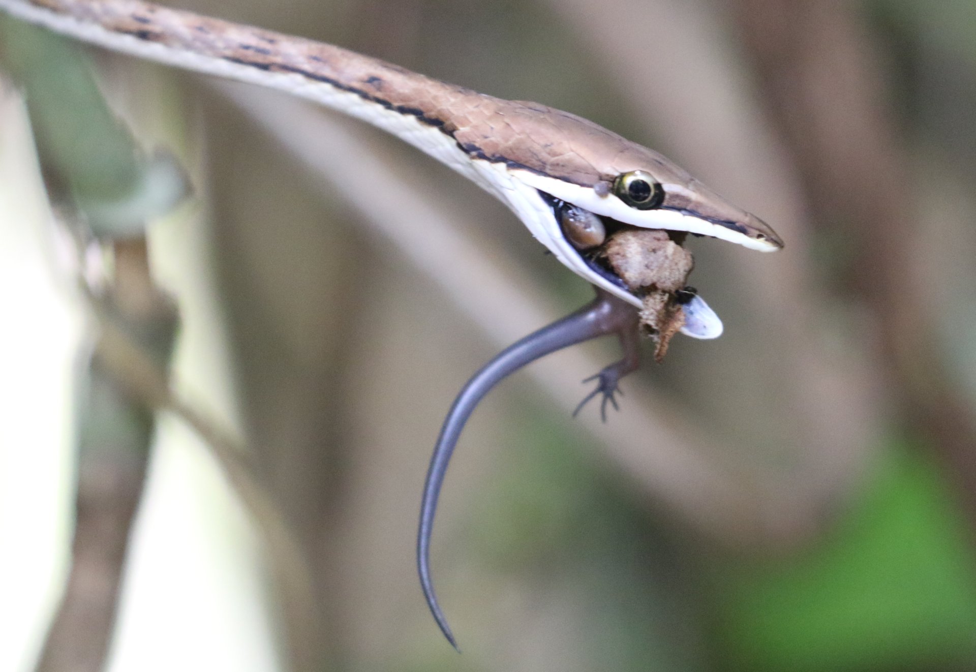
This year I made a very special vacation: two weeks of hiking in the nature in Costa Rica! It was a trip organized by my Spanish teacher Elena, and she did a fantastic job in organizing this tour! With Elena we were 14 and we had a great time, saw a lot.
Before we could really start, we had to acclimatise and also get over the Jet-Lag, for me the Jet-Lag lastet only two days. But we came directly from the German Winter, with only 10°C during the day into tropical weather with 32-35°C during the day and 20-25°C during the night.
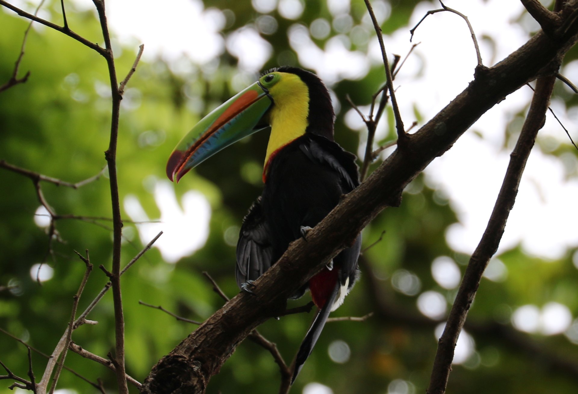
To start, we went directly from the Airport in San Jose to the Caribbean coast, to Puerto Viejo. To get accustomed, we had the beach directly across the road of our hotel. On the second day we did our first hiking tour in the national park Cahuita, where we almost had the impression to see all animals that exist in Costa Rica. Even though the park also had a beach open to visitors and used also by locals for relaxation, the park itself was “wild” enough to enjoy wild-life, except for some moneys directly at the beach (there are always some stupid people who ignore the 100 signs saying “do not feed the animals”).
From there we continued to Tortuguero. This is a quite remote place, although mostly living through tourism, brought by the National Park. There we met Barbara, a German Biologist, who is living there for more than 15 years. Next day early morning at 6am, she took us on a canoe tour into the park. She showed and explained us all the wild-life and biology there. After a late breakfast, we continued with a 3 hour walking tour through the park. Two fantastic trips!
The paddling and walking together with my photographing at 32°C and 99% humidity made it quite strenuous, probably never sweated that much in my life before. Only beaten some days later. The fantastic, very tasty and cool fruit drinks (“batidos”) later for lunch however … were not such a clever idea. In the night after, I got some “indigestion”. On the next day (a transport-day to the next location) I felt quite weak, but fortunately it was over after one day.
We continued our trip to Arenal, and the National Park Volcán Arenal. The Arenal Observatory Lodge is situated on top of a hill with fantastic views, including view to the volcano (currently dormant), and with hummingbirds flying in the park directly around the lodges. The area around the hotel has many kilometres of hiking trails very much accessible for own tours. This part of the country is located already in the mountains. So from that perspective, the temperature is not so high, around 25°C, still very much pleasant, often with a little bit of wind.
With a local guide from the Lodge, we made a first tour on the next day, directly around the lodge, very nice tour. Then we took the bus to the National-Park and made another hiking tour there. As this is located in the mountains, at an altitude of about 1300m, the landscape and the forests and plants are quite different from the hot-wet climate of the rain-forest at the Caribbean coast.
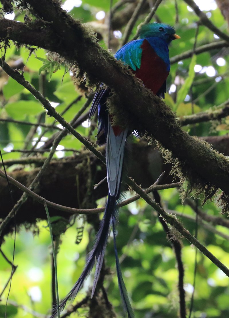
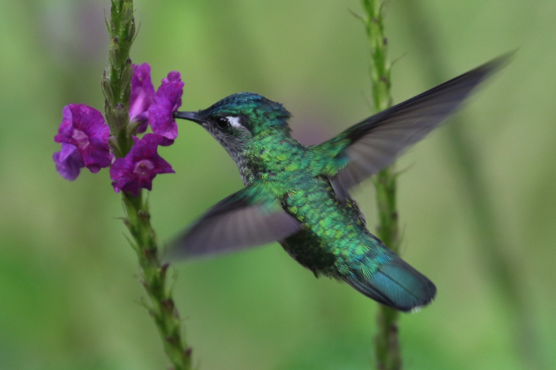
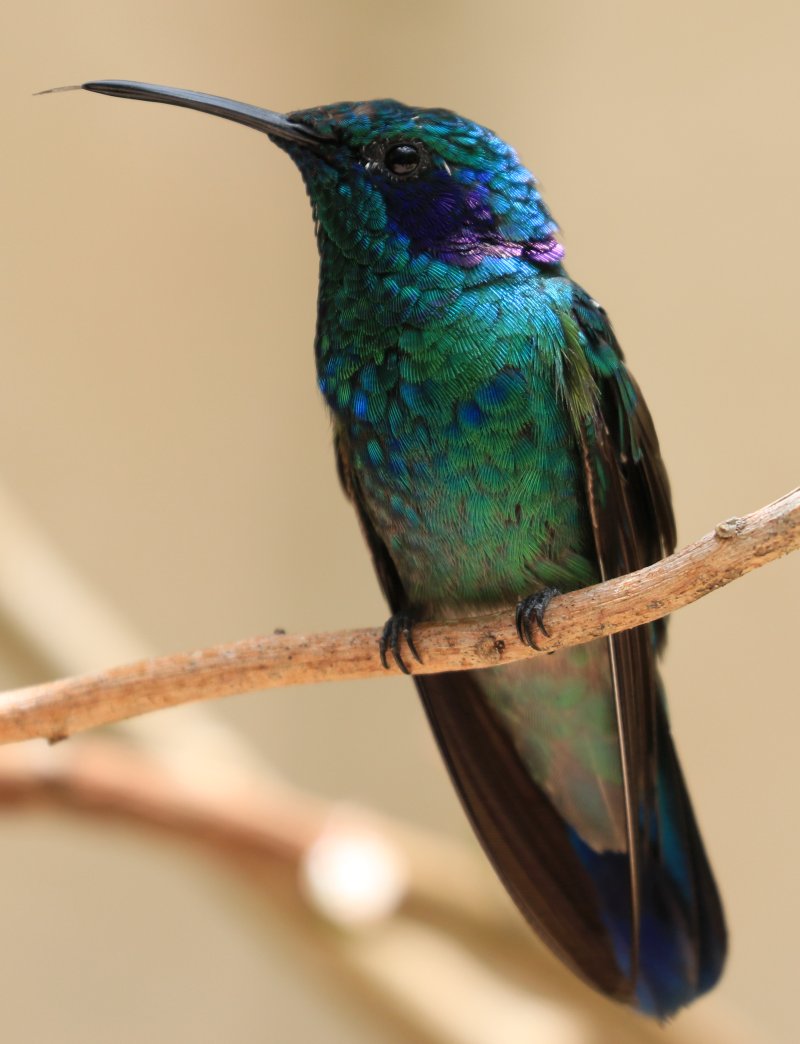
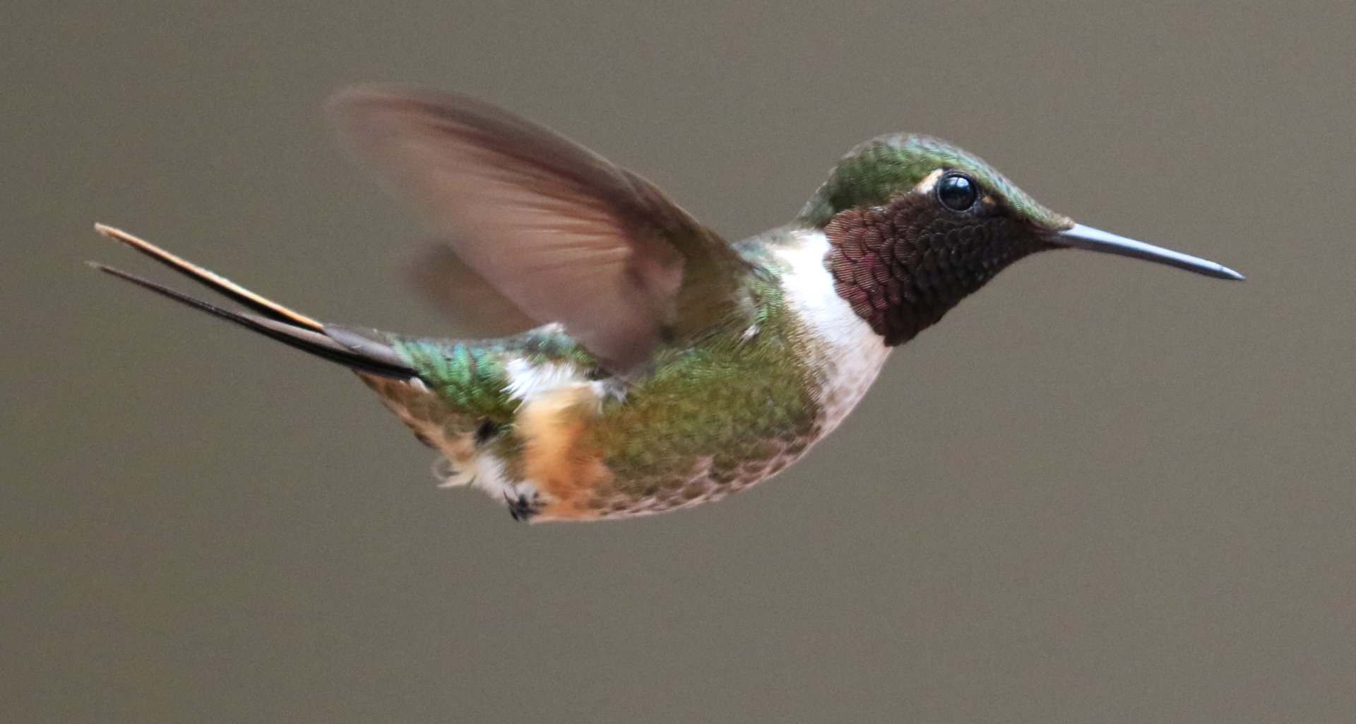
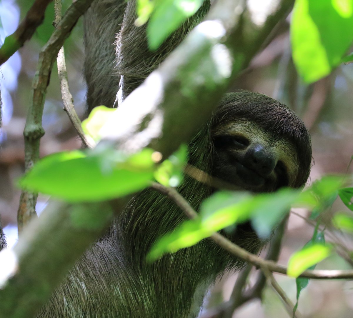
The national park Monteverde was the next station of our tour. Situated so-to-say on the other side of the mountains. The usual weather direction in Costa Rica means that we changed from a rain forest to a cloud forest area. Also here we hired a local guide, first appeared to be a quite serious person, but turned out to not only be very knowledgeable, of course, but also explained in a humorous way all the wild-life, flora and fauna, around us. But before he could even start, there was a sighting of a pair of Quetzal birds. People go there just to see them, and won’t find them for days. But we got to see them when entering the park. Really Fantastic! This is a quite rare bird species, that was already admired as a holy bird by the Maya and Aztecan. At the park entrance there is a kind of hummingbird feeding station. Although I must admit that I think such tourist attractions are questionable, I also admit that seeing a dozen hummingbirds at 2m distance (and taking fantastic pictures) is indeed a great experience. I really love those birds!
We also made a hiking tour over rope bridges in the park. The trail follows the side of hills with some ups and downs and crosses the valleys via hanging rope bridges. From there you can view straight into the treetops, which you normally only see from the bottom. A quite interesting viewpoint for a change. Muy interessante 🙂

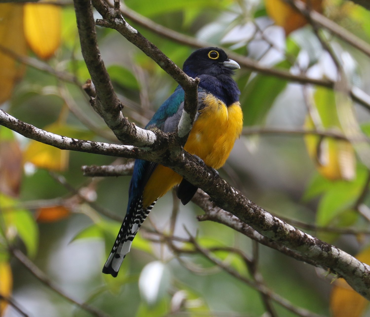
Another contrast: from the cloud forest back to rainforest at the Pacific Coast at Montezuma. Temperatures at 36-38°C and almost 100% humidity. You can only look for shade, but you sweat even if not moving. But the “not moving” part, we couldn’t do, we made another hiking tour in the national park Cabo Blanco. Although this time I left my camera backpack in the hotel and only took camera with the normal lens. Better for hiking, although I missed the tele-lens a few times. At Montezuma we also had a relaxation day, where we went with the boat to the Isla Tortuga, where we had a nice lunch and the opportunity to do some snorkelling.
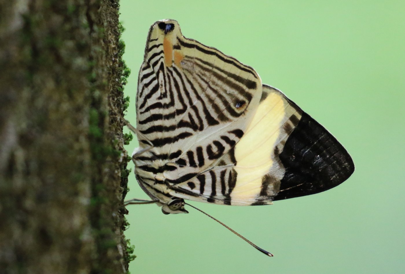
From Montezuma on to the last station in Manuel Antonio, also at the pacific coast, with a king tour in the national park with the same name, Manuel Antonio. Oh boy, never in my life did I sweat that hard. 38°C, high humidity … this time with full camera equipment … I almost melted away … but it was worth it. We took very much time to intensively watch the wildlife there… monkeys, birds, lizards of all sorts. It was really fantastic!
A small side-topic … the roads in Costa Rica: well, actually the roads are quite good. But it felt like 75% of the time we went over gravel roads. But really bad gravel roads, with pot holes the size of a Smart car. Our bus was at the borderline of what it could tolerate (and beyond), so were we.
This is a small price … for a really great country, for friendly people and fantastic nature! And once more thanks a million to Elena who organized this splendid trip, and also to Xavi our local guide, who showed us so much and also organized a lot of things every day.
My photography statistic, I took around 4500 pictures, sometimes difficult environment, with birds, monkey, reptiles behind bushes and moving foliage. With a 100-400mm focal lens, you have to experiment a bit. So in the evenings I screened and deleted pictures and brought back 1500, out of which with a big screen at home I sorted out about 950 “good ones”. I made a little picture gallery with the “Best” 165. I would say that I have about 20-30 “wow” pictures there. I think that’s a splendid result for a photo-amateur like me. So it was worth it also from that side 🙂
Hohen Neuffen
Mid of the week, the weather forecast was not very good. So it was a positive surprise that it was pleasantly warm and no rain forecasted until later in the day. So we decided to ride up the “Schwäbische Alp” at Neuffen.
Well known that the terrain before the “alp” is pretty hilly with a few rather steep climbs. But at the beginning of the tour, that’s OK. As usual, I planned the tour through small side streets and bike-ways, so we could enjoy the scenery. From Neuffen there is the climb up the Alp, with 250m altitude and 6-9% ascent. A bit of a challenge, but we are fit enough by now. We were up so early, around 11:15, that we decided to visit the old castle “ruin” of Hohen Neuffen.
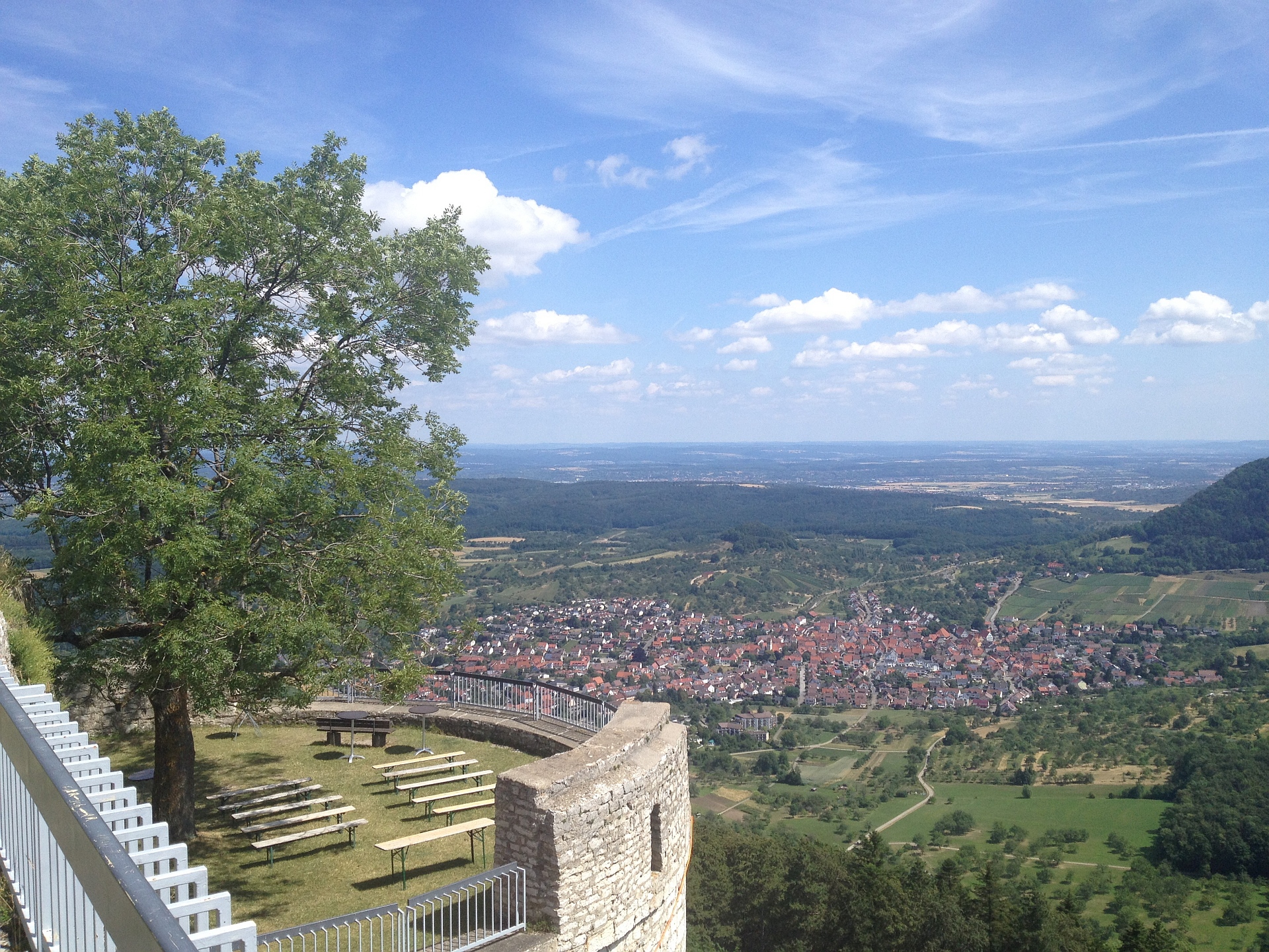
I cannot remember having been here… and was very pleasantly surprised. Not only the view is great, the “ruin” Burg Hohen Neuffen is being renovated carefully, so it looks like a ruin from far away, but insight is a Restaurant and you can even rent the place for company or private events, especially for weddings this is a great place.
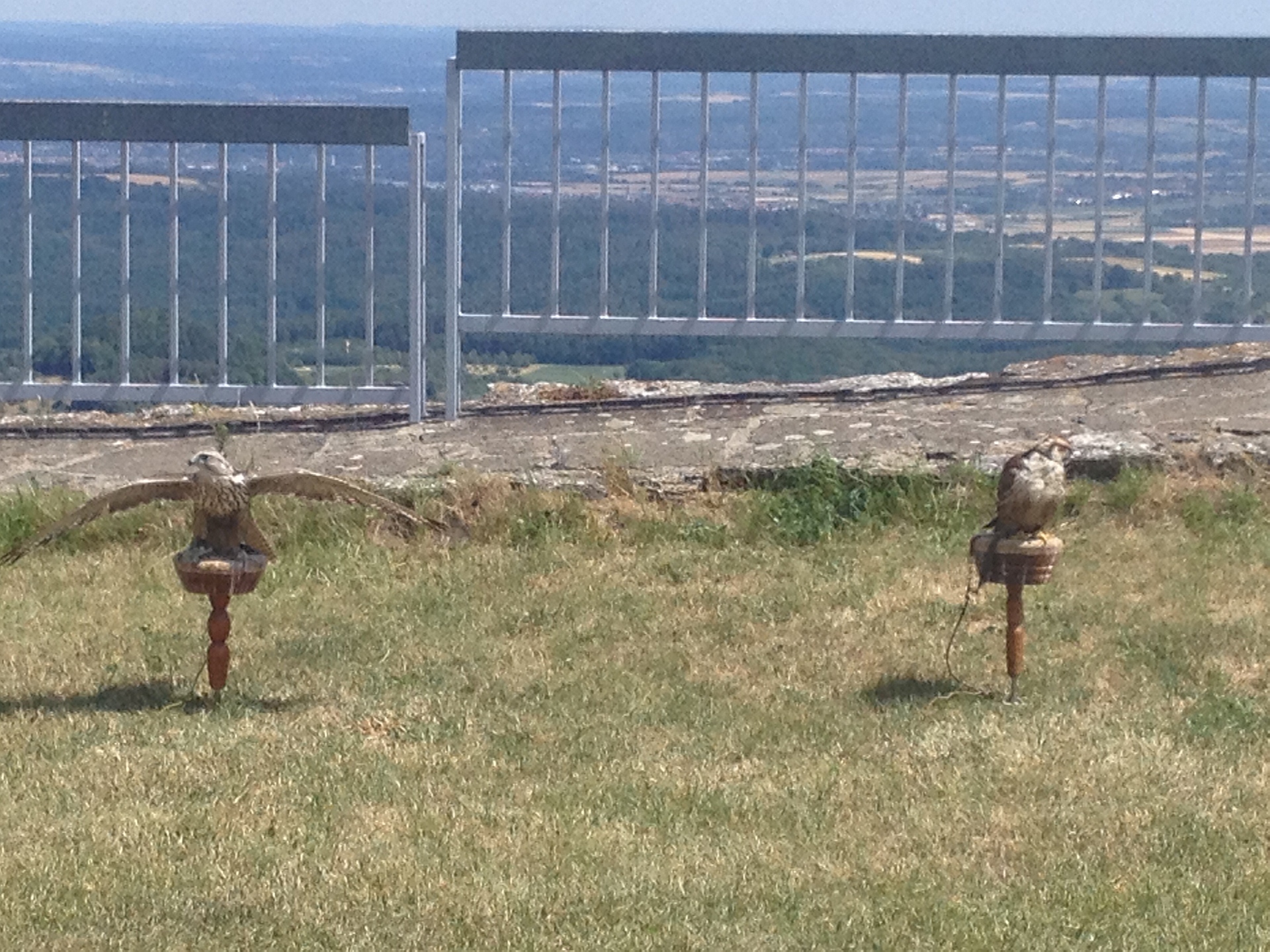
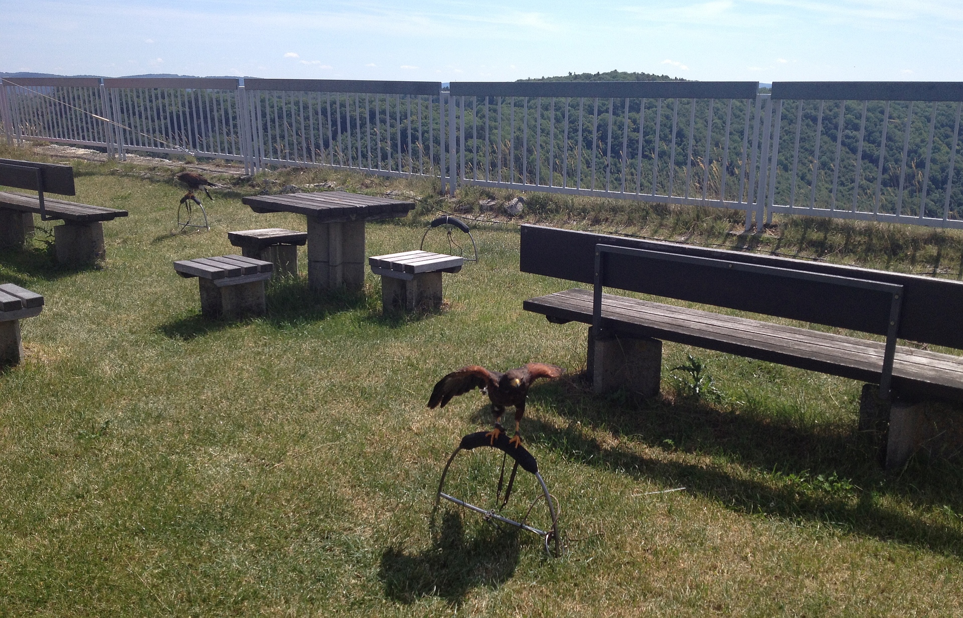
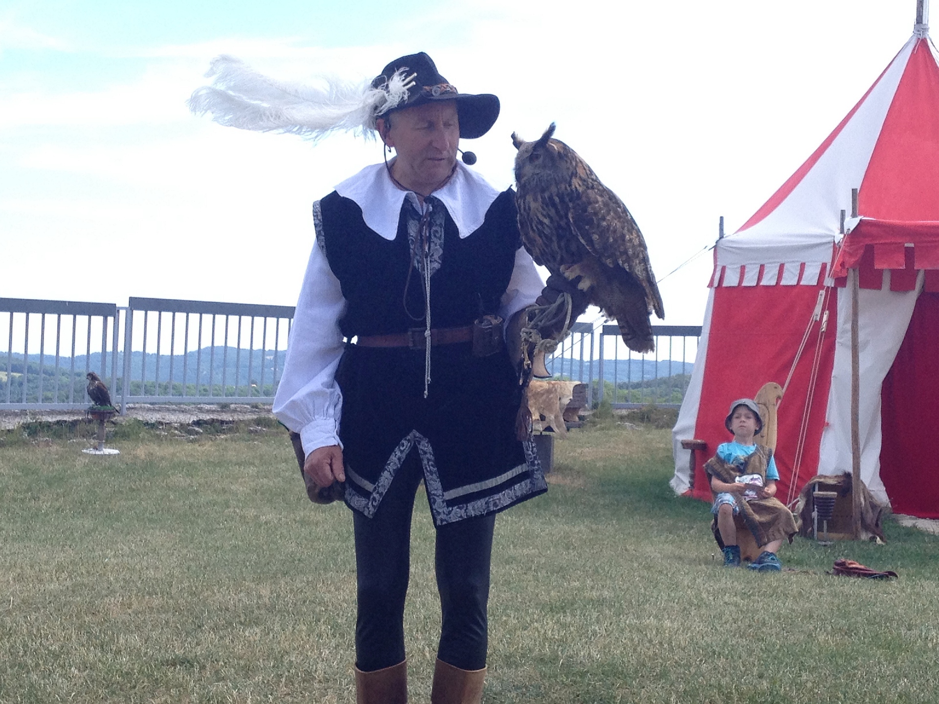
Then we saw birds, buzzards and hawks, on one of the elevated places. On Sundays and holidays, there is a falconer show there. So we didn’t take long to decide to stay and watch the show. Being here so early, waiting 20 minutes would be worth it. The show was planned for 12:00 with about 45 min. duration. It was fantastic!!! The Falconer Wolfgang Weller not only ran a great show with his birds, with hunting at highest speed, he also explained a lot of very interesting facts about the birds. Where they are from, how it works to “tame” and control them, and how they hunt in free nature. A real highlight!
Well, from there on, the rest is quickly told. We returned via Bad Urach and Metzingen into the valley of the Neckar and then upwards via Kirchentellinsfurth and Pfrondorf. In total the tour was 120km with 1130m altitude and average speed of 25,6 km/h (Tour at GPSies).
Animals and the definition of intelligence
I think that many people too quickly come to believe that (some) animals are intelligen. Specifically pet-owners tend to believe that “their” special creature definitely must be intelligent.
I’m certainly not convinced. Some time I go I thought it is easy to tell which behaviour is intelligent, or not; but today I believe that objective criteria are hard to find. It may still be possible to argue specific behaviours or specific cases, but to instate objective criteria to decide in general about intelligence… seems to be hard or impossible.
And there are astonishing specific cases. You can see reports or videos where you really wonder: is this a fake with long and specific training of the animal; is it just coincidence; or is it a collection of very specific natural behaviour pattern, that put together create the impression of intelligent behaviour; or is it really Intelligence?
Currently I tend to think that a collection of thoroughly connected pieces of behaviour, you can call it evolution of behavioural patterns, combined together … can create the impression of intelligent behaviour. But it’s not necessarily intelligence. But I would not be sure enough to rule it out.
In any case, it is a very interesting topic and fun to watch…
Tour through the valley of Nagold
Started the tour via Ehningen, Aidlingen, 7-Tannen and past Holzbronn into the Nagold-valley, then return “up” out of the valley at Iselshausen (Picture). Now I’ll see how I return home, probably via Mötzingen and Öschelbronn and Herrenberg.
Sunday Tour
The tour today goes via Aichtal, Neckartal, Grafenberg, Metzingen, Tübingen, Herrenberg (here currently the view in direction to Kayh/Mönchberg/Herrenberg) and back via Ehningen. I guess around 110km in total.
Extreme Mountain Unicycling – YouTube
Wow, fantastic. As road-biker, this is just unbelievable for me. In such terrain, only with stable hiking-boots…!
Torres del Paine | Flickr – Fotosharing!
Torres del Paine | Flickr – Fotosharing!.
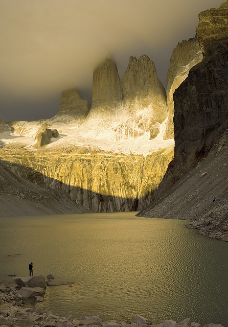
My Photos from Patagonia, Torres del Paine, are also quite good, I think:
Take care with small kids – YouTube
Update: of course its clear in the meantime that this is a well-made fake 🙂