Around the Schönbuch

The “Schönbuch” is a forest area, under protection, just next to my home-town Holzgerlingen. Of course the pathways in the forest are not paved, so with the road-bike we have to go “around”. Which is a quite nice tour, with some really great views, and can be made between 65km and 80km long.

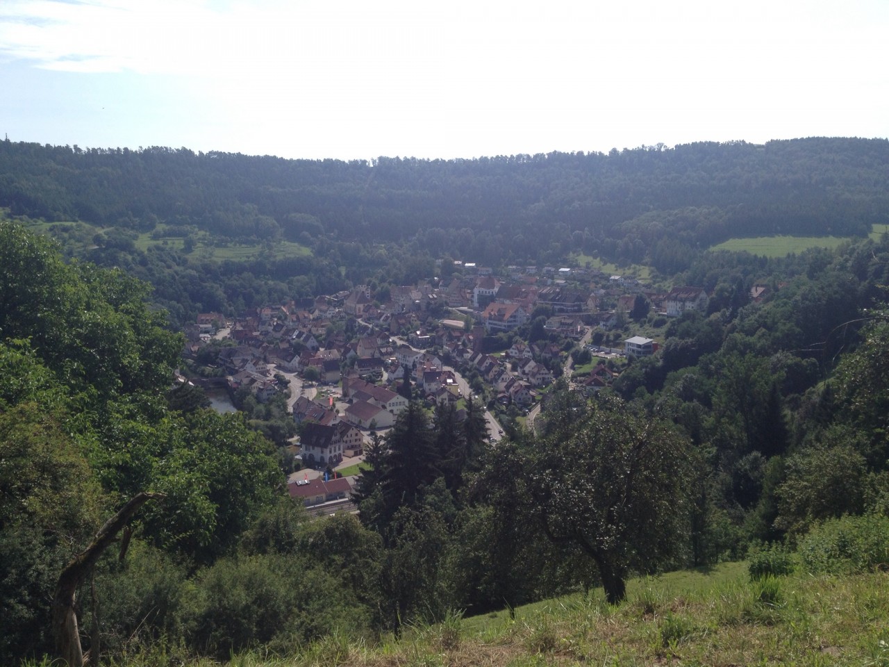
We’ve done this a few times this year, on different routes, and today was a nice Saturday to repeat another variation. Over the broad B464 “highway”, which is currently quite deserted due to road-constructions which causes most cars to go a long de-tour. Road for the bikes… This time we went to Pfrondorf and down to Kirchentellinsfurth. Quite a few times already we climbed this hill, and are usually a bit exhausted as this is then one of the last climbs of a larger tour. Today downhill… and that is really nice. So we continued via Tübingen towards Entringen.

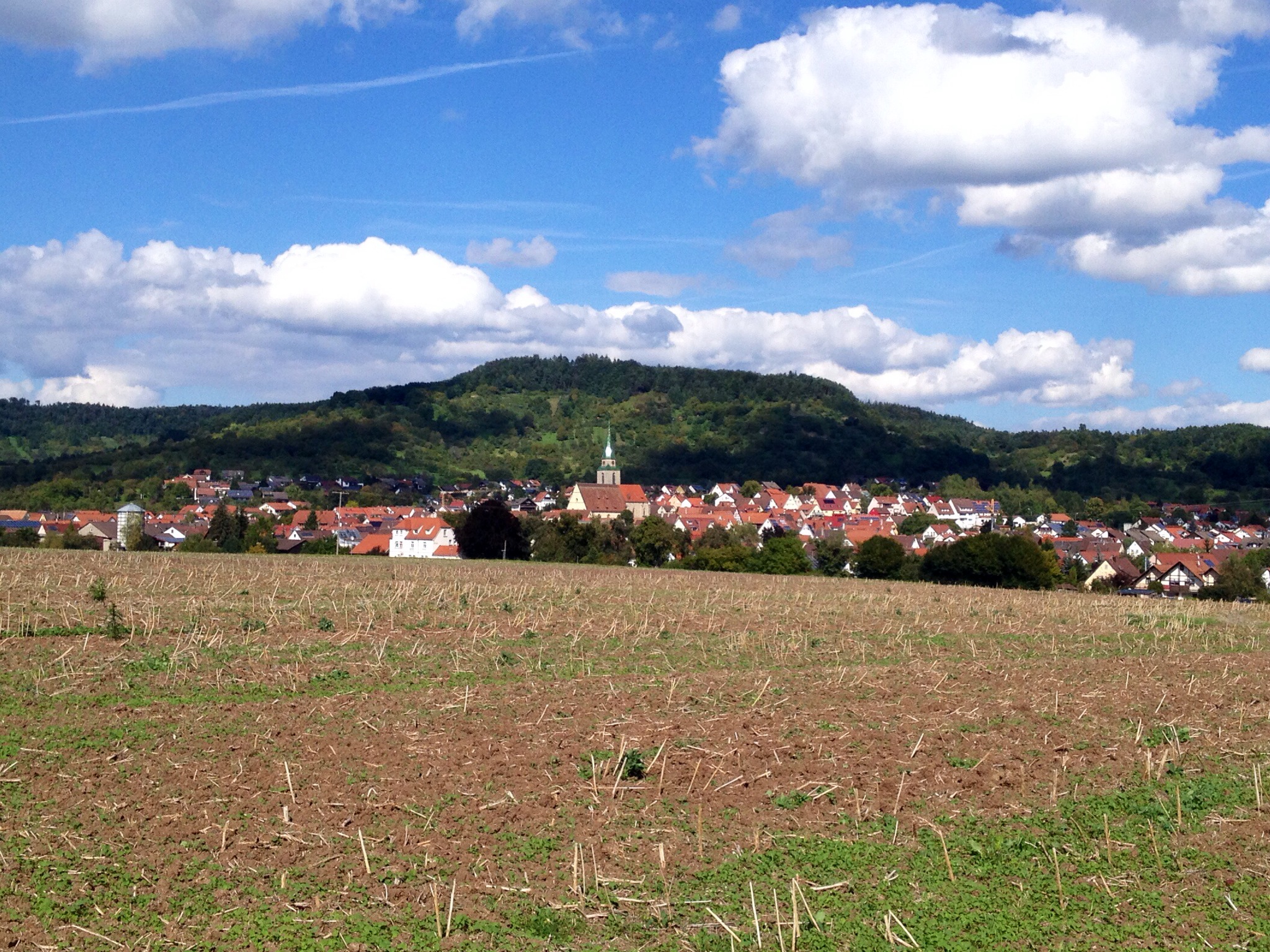
The colors were really great today. It is still summer, but the sun is not anymore coming straight down, so it seems like the colors are more intensive. The white clouds against the blue sky were fantastic today. And going over hills… you often have fantastic views. First towards the “Schwäbische Alb” and then towards the Schönbuch again, with the town of Entringen. Had to take a picture.

IMG_0238.JPG
View towards Entringen and the Schönbuch

All in all we did a relatively relaxed tour today, 72km and 540m altitude with 26,6 km/h. After a rainy week, we were once again lucky with the Saturday weather. Unfortunately the Sunday forecast is bad, rainy 🙁 .

The 5-hills tour in the Nagold valley

For a few years already we discuss regularly to run a “mountain training” along the valley of Nagold. Finally yesterday we managed. My legs today tell me, that we completed successfully!

Yes, there are of course several more climbs, but I selected 5 really nice ones and some of the steepest. The first was just to warm up, from Dätzingen towards Calw. But then first bummer, the “Öländerle”, with 15-18% steep sections. But actually quite good to climb, as there are several steep sections followed by slightly less steep parts, followed with another ramp… several times. Reaching Stammheim for a quick flat part, the climb continues towards Holzbronn to complete hill number 2.

First downhill again into the valley, and now up from Seitzental towards Altbulach. This is really nice to go, not quite so steep, I guess up to 12%. Once up, continuing in direction towards Wildberg, there is a fantastic view into the valley and over Wildberg. From here it’s already possible to see hill 4 (although not on the picture).

Blick auf Wildberg

Downhill to Wildberg we quickly cross the town on the bikeway along the Nagold river… but only shortly, as directly after the town the next hill starts left-hand of the regular bike-path: Hill 4 “Kühlenberg”. This is another bummer, starting with a normal climb, quite suddenly the steepness increases to 18% for several long ramps. Nice!

Reaching Oberjettingen via the farms (the “Höhenhöfe”), we continue down via Emmingen towards Nagold. Here we have earned a break with nice cakes and coffee. No cowards today, we take on the last one, Hill 5: directly out of Nagold we climb up the “Eisbergsteige”. Starting with the end of the houses in Nagold, this climb provides a constant climb of 15-18%… no breaks or relaxing parts. Well, I chose it that way, so no complaining… and we did it 🙂

The pure statistics doesn’t sound spectacular: 110km, approx. 1400-1600m altitude with average speed of 24 km/h, but the number of ultra-steep climbs makes this a really special one. I guess we should be well prepared for the “RTF” in Magstadt next week.

Tour on GPSies: